
Faster Swing Speed Fitting
May 28, 2025Long-Drive Club Fitting
May 28, 2025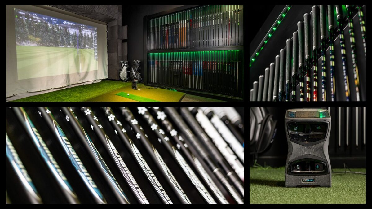
Golf Distance Optimization
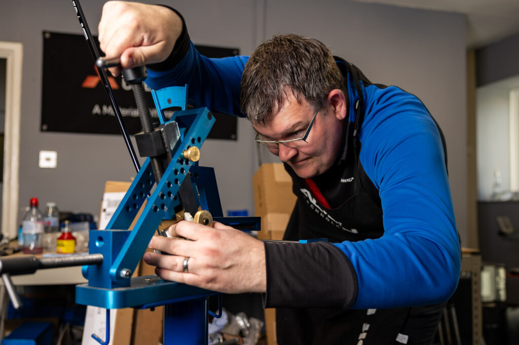
Optimizing Golf Distance Through Precision Club Fitting
When golfers think about increasing distance, the focus is often on swing changes or chasing more ball speed. While technique matters, the most reliable and repeatable distance gains come from proper golf club fitting. From a fitting perspective, distance optimization is not about hitting one club farther—it’s about building efficiency, consistency, and purpose throughout the entire bag.
By aligning launch conditions, spin rates, and gapping, a professional club fitting ensures every club delivers its maximum usable yardage. The result is longer shots where it matters, tighter dispersion, and equipment that supports smarter, more strategic golf.
What Distance Optimization Really Means in Club Fitting
Distance optimization in golf goes beyond raw carry numbers. It involves understanding how launch angle, spin rate, peak height, and angle of descent work together to create efficient ball flight. A driver that spins too much may cost carry distance, while irons that launch inconsistently can create yardage overlap that leads to indecision and missed scoring opportunities.
A comprehensive club fitting evaluates:
-
Carry distance and rollout
-
Launch angle and spin rate
-
Ball speed efficiency
-
Peak height and descent angle
-
Distance gapping across the set
-
Shot dispersion and consistency
When these variables are properly optimized, golfers gain predictable distance control across every club—from driver to wedges.
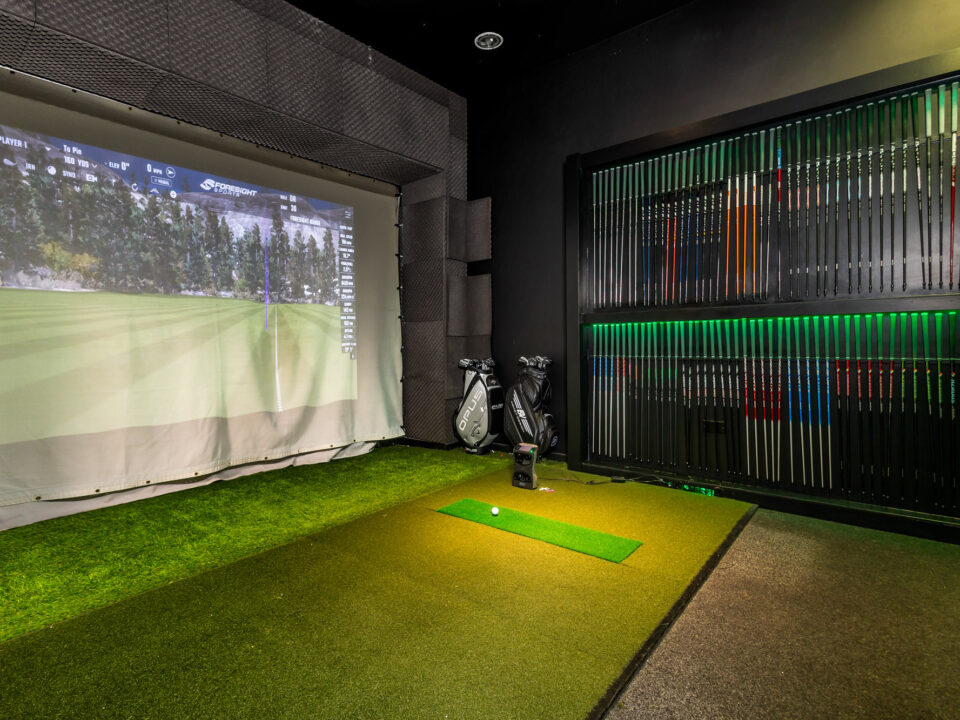
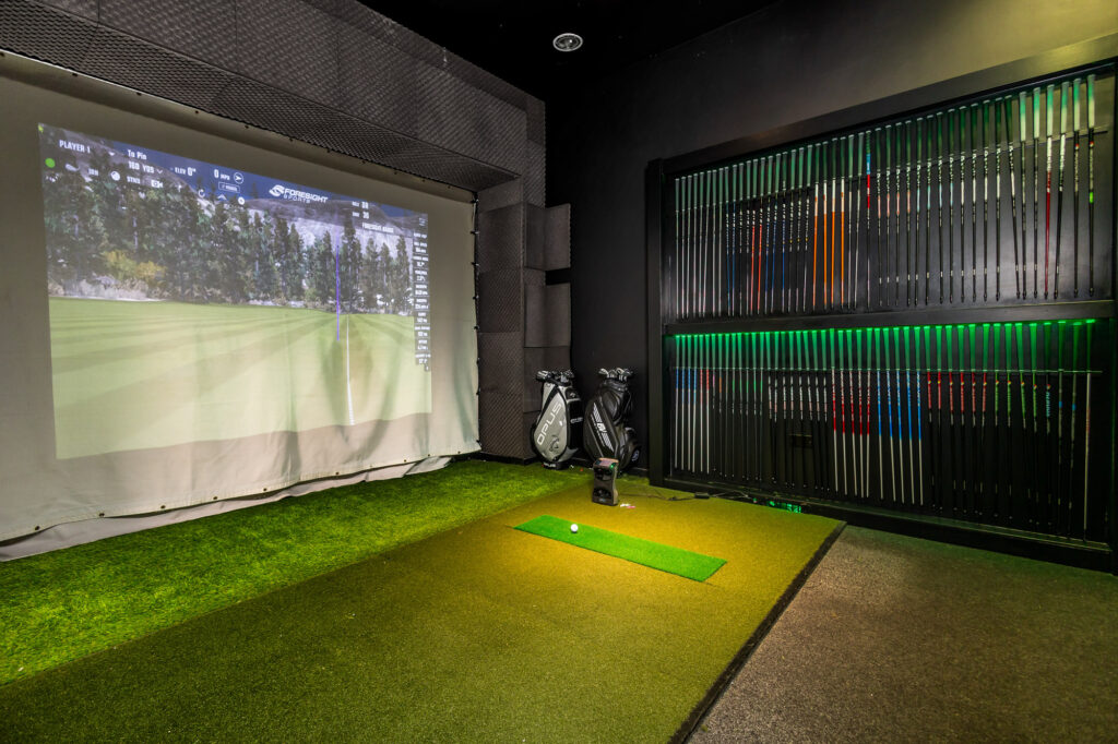
Using Launch Monitor Data to Maximize Distance Efficiency
Modern club fitting relies on radar-based launch monitors to capture precise ball flight and club delivery data. These systems provide a clear picture of how the golfer delivers the club and how the equipment influences performance.
Key metrics analyzed during a distance-focused fitting include:
-
Swing speed and ball speed
-
Smash factor
-
Launch angle
-
Spin rates
-
Club path and face angle
-
Dynamic loft and angle of attack
This data allows fitters to identify inefficiencies that may be limiting distance, such as excessive spin, poor launch conditions, or mismatched shaft profiles. Equipment changes are then tested and validated using real performance results—not assumptions.
Optimizing the Driver for Carry and Control
While distance optimization is a full-bag process, the driver remains a critical starting point. A properly fit driver maximizes carry distance without sacrificing accuracy. Adjustments to loft, head design, and shaft profile can significantly impact launch and spin characteristics.
Premium driver heads from Titleist, TaylorMade, Callaway, and Wilson Staff offer a range of center-of-gravity locations, face technologies, and adjustability options. These variables allow fitters to fine-tune launch conditions to suit individual swing dynamics.
The right driver setup produces:
-
Higher ball speed efficiency
-
Optimal launch and spin windows
-
Improved dispersion
-
More consistent carry distance
Distance Gapping and Iron Set Optimization
Iron distance optimization is about consistency and separation. When irons are improperly fit, it’s common to see overlapping yardages—such as a 6-iron traveling the same distance as a 7-iron—or excessive gaps that disrupt course strategy.
Through careful head, shaft, and loft selection, club fitting ensures:
-
Proper distance progression between irons
-
Consistent launch and spin windows
-
Predictable carry distances
-
Improved descent angles for green-holding ability
Iron heads from leading manufacturers like Titleist, TaylorMade, Callaway, Wilson Staff, Srixon and Miura offer varying levels of forgiveness, ball speed technology, and launch characteristics that can be matched to a golfer’s needs.
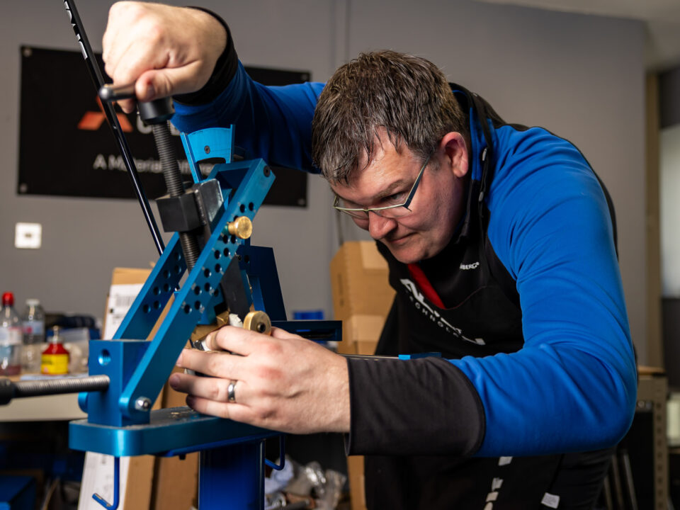
The Role of Shaft Selection in Distance Optimization
Shaft fitting is one of the most influential—and often overlooked—components of distance optimization. The correct shaft improves timing, energy transfer, and consistency, allowing golfers to maximize distance without increasing effort.
High-performance shaft brands such as Fujikura, Mitsubishi Chemical, Graphite Design, Project X, Ture Temper, Nippon and KBS provide extensive fitting matrices that vary in:
-
Weight
-
Flex profile
-
Torque
-
Launch and spin characteristics
Matching the shaft to a golfer’s tempo, transition, and release pattern helps stabilize impact and optimize launch conditions throughout the set.
Wedges and the Importance of Distance Control
Distance optimization does not stop at long clubs. Proper wedge gapping is essential for scoring. Inconsistent wedge distances can lead to missed greens and poor proximity to the hole.
A distance-focused fitting evaluates:
-
Loft spacing
-
Shaft consistency
-
Partial-shot carry distances
-
Trajectory and spin control
When wedges are properly fit, golfers gain confidence in approach shots and short-game precision.
Why Full-Bag Distance Optimization Leads to Lower Scores
When distance is optimized across the entire bag, golfers experience measurable performance benefits:
-
Clear club selection decisions
-
Improved course management
-
More consistent scoring opportunities
-
Reduced guesswork under pressure
Rather than swinging harder, golfers rely on equipment that works efficiently with their natural motion.
Distance Optimization Is an Equipment Strategy, Not a Swing Fix
Ultimately, distance optimization through club fitting is about engineering performance. By combining advanced launch monitor data, expert analysis, and premium components, golfers can build a set that performs cohesively from top to bottom.
Optimized distance isn’t about hitting one club farther—it’s about making every club work smarter together.
Experience golf equipment perfected. Book Your Premium Fitting today.


Coming back and using custom lab and tom especially.


Custom Lab Golf are the best!

Book Your Appointment
Areas We Cover
Bedfordshire
Bedford Area
- Bedford: MK40–MK45
- Kempston: MK42
- Bromham: MK43
- Great Barford: MK44
Luton Area
- Luton: LU1–LU4
- Stopsley: LU2
- Leagrave: LU4
Dunstable Area
- Dunstable: LU5–LU6
- Houghton Regis: LU5
- Toddington: LU5
Leighton Buzzard Area
- Leighton Buzzard: LU7
- Heath and Reach: LU7
- Linslade: LU7
Biggleswade Area
- Biggleswade: SG18
- Sandy: SG19
- Potton: SG19
Flitwick and Ampthill Area
- Flitwick: MK45
- Ampthill: MK45
- Maulden: MK45
Shefford Area
- Shefford: SG17
- Henlow: SG16
- Clifton: SG17
Smaller Towns and Villages in Bedfordshire
- Arlesey: SG15
- Stotfold: SG5
- Sharnbrook: MK44
- Oakley: MK43
- Wootton: MK43
- Marston Moretaine: MK43
- Harrold: MK43
- Cranfield: MK43
- Aspley Guise: MK17
- Silsoe: MK45
London
WC Postcodes (Western Central)
- WC1: Bloomsbury, Gray's Inn (Camden, Islington)
- WC2: Covent Garden, Leicester Square, Holborn, Strand (Camden, Westminster)
EC Postcodes (Eastern Central)
- EC1: Clerkenwell, Finsbury, Barbican (Islington, City of London)
- EC2: Moorgate, Liverpool Street, Shoreditch (City of London, Hackney)
- EC3: Monument, Tower Hill, Aldgate (City of London)
- EC4: Fleet Street, St Paul's, Blackfriars (City of London, Westminster)
W Postcodes (West London)
- W1: Mayfair, Marylebone, Soho, Fitzrovia (Westminster, Camden)
SW Postcodes (South West London)
- SW1: Westminster, Belgravia, Pimlico, Victoria
SE Postcodes (South East London)
- SE1: South Bank, Bermondsey, Borough
London (Wider Area) Postcodes
North London (N Postcodes)
- N1: Islington, Barnsbury, Canonbury
- N2: East Finchley
- N3: Finchley Central
- N4: Finsbury Park, Manor House
- N5: Highbury
- N6: Highgate
- N7: Holloway
- N8: Crouch End, Hornsey
- N9: Edmonton
- N10: Muswell Hill
- N11: New Southgate
- N12: North Finchley, Woodside Park
- N13: Palmers Green
- N14: Southgate
- N15: Seven Sisters
- N16: Stoke Newington
- N17: Tottenham
- N18: Upper Edmonton
- N19: Archway, Tufnell Park
- N20: Whetstone, Totteridge
- N21: Winchmore Hill
- N22: Wood Green
East London (E Postcodes)
- E1: Whitechapel, Stepney, Mile End
- E2: Bethnal Green
- E3: Bow, Bromley-by-Bow
- E4: Chingford, Highams Park
- E5: Clapton
- E6: East Ham
- E7: Forest Gate
- E8: Hackney, Dalston
- E9: Hackney Wick, Homerton
- E10: Leyton
- E11: Leytonstone
- E12: Manor Park
- E13: Plaistow
- E14: Canary Wharf, Poplar, Isle of Dogs
- E15: Stratford, West Ham
- E16: Canning Town, North Woolwich
- E17: Walthamstow
- E18: South Woodford
- E20: Olympic Park
West London (W Postcodes)
- W2: Bayswater, Paddington
- W3: Acton
- W4: Chiswick
- W5: Ealing
- W6: Hammersmith
- W7: Hanwell
- W8: Kensington
- W9: Maida Vale, Warwick Avenue
- W10: Ladbroke Grove, North Kensington
- W11: Notting Hill
- W12: Shepherd's Bush
- W13: West Ealing
- W14: West Kensington
South West London (SW Postcodes)
- SW2: Brixton, Streatham Hill
- SW3: Chelsea
- SW4: Clapham
- SW5: Earl's Court
- SW6: Fulham, Parsons Green
- SW7: South Kensington
- SW8: South Lambeth, Nine Elms
- SW9: Stockwell, Brixton
- SW10: West Brompton, World's End
- SW11: Battersea, Clapham Junction
- SW12: Balham
- SW13: Barnes
- SW14: Mortlake, East Sheen
- SW15: Putney, Roehampton
- SW16: Streatham
- SW17: Tooting
- SW18: Wandsworth, Southfields
- SW19: Wimbledon, Merton
- SW20: Raynes Park
South East London (SE Postcodes)
- SE2: Abbey Wood
- SE3: Blackheath, Westcombe Park
- SE4: Brockley, Crofton Park
- SE5: Camberwell
- SE6: Catford
- SE7: Charlton
- SE8: Deptford
- SE9: Eltham, Mottingham
- SE10: Greenwich
- SE11: Kennington
- SE12: Lee
- SE13: Lewisham
- SE14: New Cross
- SE15: Peckham, Nunhead
- SE16: Rotherhithe, Surrey Quays
- SE17: Walworth
- SE18: Woolwich
- SE19: Upper Norwood
- SE20: Anerley, Penge
- SE21: Dulwich
- SE22: East Dulwich
- SE23: Forest Hill
- SE24: Herne Hill
- SE25: South Norwood
- SE26: Sydenham
- SE27: West Norwood
- SE28: Thamesmead
North West London (NW Postcodes)
- NW1: Camden Town, Regents Park
- NW2: Cricklewood, Dollis Hill
- NW3: Hampstead, Swiss Cottage
- NW4: Hendon
- NW5: Kentish Town
- NW6: Kilburn, Queens Park
- NW7: Mill Hill
- NW8: St John's Wood
- NW9: Colindale, Kingsbury
- NW10: Willesden, Harlesden
- NW11: Golders Green
Hertfordshire
St Albans Area
- St Albans: AL1–AL4
- Harpenden: AL5
- Wheathampstead: AL4
Watford Area
- Watford: WD17–WD25
- Rickmansworth: WD3
- Croxley Green: WD3
- Bushey: WD23
- Oxhey: WD19
Hemel Hempstead Area
- Hemel Hempstead: HP1–HP3
- Kings Langley: WD4
- Berkhamsted: HP4
- Tring: HP23
Stevenage Area
- Stevenage: SG1–SG2
- Knebworth: SG3
- Codicote: SG4
Hertford Area
- Hertford: SG13–SG14
- Ware: SG12
- Buntingford: SG9
Welwyn Garden City Area
- Welwyn Garden City: AL7–AL8
- Welwyn: AL6
Hitchin Area
- Hitchin: SG4–SG5
- Letchworth Garden City: SG6
- Baldock: SG7
Hatfield Area
- Hatfield: AL9–AL10
- Brookmans Park: AL9
Bishop's Stortford Area
- Bishop's Stortford: CM23
- Sawbridgeworth: CM21
Cheshunt and Broxbourne Area
- Cheshunt: EN8
- Broxbourne: EN10
- Hoddesdon: EN11
Royston Area
- Royston: SG8
Radlett and Surrounding Villages
- Radlett: WD7
- Shenley: WD7
Smaller Villages and Surrounding Areas in Hertfordshire
- Abbots Langley: WD5
- Redbourn: AL3
- Markyate: AL3
- Stanstead Abbotts: SG12
- Cuffley: EN6
- Potters Bar: EN6
- Much Hadham: SG10
Essex
Chelmsford Area
- Chelmsford: CM1–CM3
- Writtle: CM1
- Great Baddow: CM2
- Danbury: CM3
Colchester Area
- Colchester: CO1–CO7
- Wivenhoe: CO7
- Tiptree: CO5
- Marks Tey: CO6
Southend-on-Sea Area
- Southend-on-Sea: SS0–SS9
- Leigh-on-Sea: SS9
- Shoeburyness: SS3
- Westcliff-on-Sea: SS0
Basildon Area
- Basildon: SS13–SS16
- Pitsea: SS13
- Laindon: SS15
- Wickford: SS11–SS12
Harlow Area
- Harlow: CM17–CM20
- Old Harlow: CM17
Brentwood Area
- Brentwood: CM13–CM15
- Shenfield: CM15
- Ingatestone: CM4
Braintree Area
- Braintree: CM7–CM8
- Halstead: CO9
- Witham: CM8
Clacton-on-Sea Area
- Clacton-on-Sea: CO15–CO16
- Frinton-on-Sea: CO13
- Walton-on-the-Naze: CO14
- Jaywick: CO15
Epping Area
- Epping: CM16
- Loughton: IG10
- Chigwell: IG7
- Buckhurst Hill: IG9
Maldon Area
- Maldon: CM9
- Burnham-on-Crouch: CM0
Saffron Walden Area
- Saffron Walden: CB10–CB11
- Great Dunmow: CM6
Canvey Island Area
- Canvey Island: SS8
- Benfleet: SS7
Rayleigh and Rochford Area
- Rayleigh: SS6
- Rochford: SS4
Tilbury and Thurrock Area
- Tilbury: RM18
- Grays: RM17, RM20
- Stanford-le-Hope: SS17
Smaller Towns and Villages in Essex
- Thaxted: CM6
- Great Leighs: CM3
- Coggeshall: CO6
- Brightlingsea: CO7
- South Woodham Ferrers: CM3
- Waltham Abbey: EN9
- Ongar: CM5
- Debden: CB11
- Hockley: SS5
Kent
Maidstone Area
- Maidstone: ME14–ME17
- Bearsted: ME14
- Headcorn: TN27
- Lenham: ME17
Canterbury Area
- Canterbury: CT1–CT4
- Whitstable: CT5
- Herne Bay: CT6
- Sturry: CT2
Ashford Area
- Ashford: TN23–TN27
- Tenterden: TN30
- Wye: TN25
Dartford Area
- Dartford: DA1–DA2
- Crayford: DA1
- Greenhithe: DA9
- Swanscombe: DA10
Sevenoaks Area
- Sevenoaks: TN13–TN15
- Westerham: TN16
- Edenbridge: TN8
Tunbridge Wells Area
- Royal Tunbridge Wells: TN1–TN4
- Southborough: TN4
- Pembury: TN2
- Paddock Wood: TN12
Tonbridge Area
- Tonbridge: TN9–TN12
- Hildenborough: TN11
Folkestone and Hythe Area
- Folkestone: CT18–CT20
- Hythe: CT21
- Sandgate: CT20
Dover Area
- Dover: CT16–CT17
- Deal: CT14
- Sandwich: CT13
Thanet Area
- Margate: CT9
- Ramsgate: CT11–CT12
- Broadstairs: CT10
- Westgate-on-Sea: CT8
Medway Area (Chatham, Gillingham, Rochester)
- Chatham: ME4–ME5
- Gillingham: ME7–ME8
- Rochester: ME1–ME3
- Rainham: ME8
Gravesend Area
- Gravesend: DA11–DA12
- Northfleet: DA11
Smaller Towns and Villages in Kent
- Aylesford: ME20
- Snodland: ME6
- West Malling: ME19
- East Malling: ME19
- Sittingbourne: ME9–ME10
- Faversham: ME13
- New Romney: TN28
- Lydd: TN29
- Cranbrook: TN17
- Hawkhurst: TN18
East Sussex
Brighton and Hove Area
- Brighton: BN1, BN2, BN41
- Hove: BN3
- Portslade: BN41
Eastbourne Area
- Eastbourne: BN20–BN23
- Willingdon: BN22
- Hampden Park: BN22
Hastings Area
- Hastings: TN34–TN35
- St Leonards-on-Sea: TN37–TN38
Lewes Area
- Lewes: BN7, BN8
- Ringmer: BN8
- Newhaven: BN9
- Peacehaven: BN10
- Seaford: BN25
Uckfield Area
- Uckfield: TN22
- Buxted: TN22
- Maresfield: TN22
Crowborough Area
- Crowborough: TN6
- Rotherfield: TN6
Battle Area
- Battle: TN33
- Robertsbridge: TN32
Rye Area
- Rye: TN31
- Winchelsea: TN36
Smaller Towns and Villages in East Sussex
- Alfriston: BN26
- Polegate: BN26
- Hailsham: BN27
- Heathfield: TN21
- Wadhurst: TN5
- Ticehurst: TN5
- Pevensey: BN24
- Ditchling: BN6
- Rottingdean: BN2
- Glynde: BN8
West Sussex
Chichester Area
- Chichester: PO18–PO20
- Bosham: PO18
- Selsey: PO20
- Midhurst: GU29
- Petworth: GU28
Crawley Area
- Crawley: RH10–RH11
- Gatwick Airport: RH6
Horsham Area
- Horsham: RH12–RH13
- Southwater: RH13
- Billingshurst: RH14
Worthing Area
- Worthing: BN11–BN14
- Goring-by-Sea: BN12
- Findon: BN14
Littlehampton Area
- Littlehampton: BN16–BN17
- Rustington: BN16
- Arundel: BN18
Bognor Regis Area
- Bognor Regis: PO21–PO22
- Aldwick: PO21
- Felpham: PO22
Haywards Heath Area
- Haywards Heath: RH16–RH17
- Lindfield: RH16
- Cuckfield: RH17
East Grinstead Area
- East Grinstead: RH19
- Forest Row: RH18
Burgess Hill Area
- Burgess Hill: RH15
Smaller Towns and Villages in West Sussex
- Pulborough: RH20
- Storrington: RH20
- Henfield: BN5
- Steyning: BN44
- Hassocks: BN6
- Lancing: BN15
- Shoreham-by-Sea: BN43
- Upper Beeding: BN44
- Amberley: BN18
- West Wittering: PO20
Surrey
Guildford Area
- Guildford: GU1–GU4
- Shalford: GU4
- Ash: GU12
- Godalming: GU7
Woking Area
- Woking: GU21–GU22
- Knaphill: GU21
- West Byfleet: KT14
Epsom and Ewell Area
- Epsom: KT17–KT19
- Ewell: KT17
- Stoneleigh: KT17
Leatherhead Area
- Leatherhead: KT22–KT24
- Fetcham: KT22
- Bookham: KT23
Reigate and Redhill Area
- Reigate: RH2
- Redhill: RH1
- Merstham: RH1
- Horley: RH6
Farnham Area
- Farnham: GU9–GU10
- Hindhead: GU26
- Frensham: GU10
Camberley Area
- Camberley: GU15
- Frimley: GU16
- Bagshot: GU19
Dorking Area
- Dorking: RH4–RH5
- Westcott: RH4
- Brockham: RH3
Walton-on-Thames and Weybridge Area
- Walton-on-Thames: KT12
- Weybridge: KT13
- Hersham: KT12
Esher and Cobham Area
- Esher: KT10
- Cobham: KT11
- Claygate: KT10
Staines and Egham Area
- Staines-upon-Thames: TW18–TW19
- Egham: TW20
- Englefield Green: TW20
Smaller Towns and Villages in Surrey
- Chertsey: KT16
- Addlestone: KT15
- Byfleet: KT14
- Oxshott: KT22
- Virginia Water: GU25
- Windlesham: GU20
- Chobham: GU24
- Cranleigh: GU6
- Lingfield: RH7
- Warlingham: CR6
- Caterham: CR3
- Oxted: RH8
Berkshire
Reading Area
- Reading: RG1–RG2, RG4, RG6, RG30–RG31
- Tilehurst: RG30–RG31
- Caversham: RG4
- Earley: RG6
Slough Area
- Slough: SL1–SL3
- Langley: SL3
- Colnbrook: SL3
Windsor and Maidenhead Area
- Windsor: SL4
- Maidenhead: SL6
- Ascot: SL5
- Bray: SL6
Newbury Area
- Newbury: RG14, RG20
- Thatcham: RG18–RG19
- Hungerford: RG17
Bracknell Area
- Bracknell: RG12
- Binfield: RG42
- Warfield: RG42
Wokingham Area
- Wokingham: RG40–RG41
- Finchampstead: RG40
- Winnersh: RG41
West Berkshire Villages
- Pangbourne: RG8
- Theale: RG7
- Aldermaston: RG7
- Burghfield: RG30
Smaller Towns and Villages in Berkshire
- Eton: SL4
- Cookham: SL6
- Datchet: SL3
- Sunningdale: SL5
- Mortimer: RG7
- Kintbury: RG17
- Lambourn: RG17
- Crowthorne: RG45
- Twyford: RG10
- Sandhurst: GU47
Buckinghamshire
Milton Keynes Area
- Milton Keynes: MK1–MK19
- Bletchley: MK1, MK2
- Stony Stratford: MK11
- Newport Pagnell: MK16
Aylesbury Area
- Aylesbury: HP19–HP21
- Wendover: HP22
- Stone: HP17
- Princes Risborough: HP27
High Wycombe Area
- High Wycombe: HP10–HP15
- Marlow: SL7
- Bourne End: SL8
- Beaconsfield: HP9
Amersham Area
- Amersham: HP6
- Chesham: HP5
- Great Missenden: HP16
- Little Chalfont: HP6
Chesham and the Chalfonts Area
- Chesham: HP5
- Chalfont St Peter: SL9
- Chalfont St Giles: HP8
- Gerrards Cross: SL9
Buckingham Area
- Buckingham: MK18
- Winslow: MK18
Marlow Area
- Marlow: SL7
- Cookham: SL6
- Bourne End: SL8
Waddesdon Area
- Waddesdon: HP18
- Quainton: HP22
Smaller Towns and Villages in Buckinghamshire
- Olney: MK46
- Winslow: MK18
- Buckingham: MK18
- Hazlemere: HP15
- Flackwell Heath: HP10
- Thame: OX9
- Ivinghoe: LU7
- Linslade: LU7
- Beaconsfield: HP9
- Wendover: HP22
- Princes Risborough: HP27
Oxfordshire
Oxford Area
- Oxford: OX1–OX4
- Headington: OX3
- Cowley: OX4
- Summertown: OX2
- Marston: OX3
- Abingdon: OX14
- Botley: OX2
Banbury Area
- Banbury: OX16–OX17
- Bicester: OX26
- Chipping Norton: OX7
- Adderbury: OX17
Bicester Area
- Bicester: OX25
- Kidlington: OX5
- Yarnton: OX5
- Kirtlington: OX5
Didcot Area
- Didcot: OX11
- Wallingford: OX10
- Wantage: OX12
- Grove: OX12
Wallingford Area
- Wallingford: OX10
- Berinsfield: OX10
- Cholsey: OX10
Abingdon Area
- Abingdon: OX14
- Radley: OX14
- Drayton: OX14
- Marcham: OX13
Witney Area
- Witney: OX28–OX29
- Long Hanborough: OX29
- Eynsham: OX29
Henley-on-Thames Area
- Henley-on-Thames: RG9
- Marlow: SL7
- Nuffield: OX49
Thame Area
- Thame: OX9
- Wheatley: OX33
Abingdon and Oxford South Area
- Abingdon: OX14
- Wantage: OX12
- Grove: OX12
Smaller Towns and Villages in Oxfordshire
- Chipping Norton: OX7
- Faringdon: SN7
- Burford: OX18
- Charlbury: OX7
- Henley-on-Thames: RG9
- Long Compton: CV36
- Stanton Harcourt: OX29
- Kidlington: OX5
- Deddington: OX15
- Steeple Aston: OX25
Hampshire
Southampton Area
- Southampton: SO14–SO19
- Bitterne: SO18
- Eastleigh: SO50
- Shirley: SO15
- Hedge End: SO30
Portsmouth Area
- Portsmouth: PO1–PO6
- Southsea: PO5
- Cosham: PO6
- Fareham: PO14–PO16
- Havant: PO9
Basingstoke Area
- Basingstoke: RG21–RG22
- Tadley: RG26
- Bramley: RG26
Winchester Area
- Winchester: SO22–SO23
- Alresford: SO24
- Chandlers Ford: SO53
- Kings Worthy: SO23
Andover Area
- Andover: SP10–SP11
- Whitchurch: RG28
- Ludgershall: SP11
Farnborough Area
- Farnborough: GU14
- Aldershot: GU11
- Fleet: GU51
Havant and Waterlooville Area
- Waterlooville: PO7
- Havant: PO9
- Rowlands Castle: PO9
Lymington Area
- Lymington: SO41
- New Milton: BH25
- Sway: SO41
New Forest Area
- Lyndhurst: SO43
- Fordingbridge: SP6
- Ringwood: BH24
Eastleigh Area
- Eastleigh: SO50
- Chandler's Ford: SO53
- Hedge End: SO30
Aldershot Area
- Aldershot: GU11
- Farnborough: GU14
- Farnham: GU9
Smaller Towns and Villages in Hampshire
- Liphook: GU30
- Hook: RG27
- Petersfield: GU31
- Romsey: SO51
- Alton: GU34
- Stubbington: PO14
- Bishop's Waltham: SO32
- Highcliffe: BH23
- Totton: SO40
- Hurstbourne Tarrant: SP11
Wiltshire
Salisbury Area
- Salisbury: SP1–SP5
- Amesbury: SP4
- Wilton: SP2
- Fordingbridge: SP6
Swindon Area
- Swindon: SN1–SN5
- Wroughton: SN4
- Highworth: SN6
- Royal Wootton Bassett: SN4
Chippenham Area
- Chippenham: SN14
- Corsham: SN13
- Calne: SN11
Trowbridge Area
- Trowbridge: BA14
- Melksham: SN12
- Westbury: BA13
Devizes Area
- Devizes: SN10
- Pewsey: SN9
- Marlborough: SN8
Warminster Area
- Warminster: BA12
- Frome: BA11
- Norton St. Philip: BA2
Lacock Area
- Lacock: SN15
- Bowden Hill: SN15
Marlborough Area
- Marlborough: SN8
- Ramsbury: SN8
- Great Bedwyn: SN8
Royal Wootton Bassett Area
- Royal Wootton Bassett: SN4
- Lydiard Millicent: SN5
- Purton: SN5
Smaller Towns and Villages in Wiltshire
- Bradford-on-Avon: BA15
- Broughton Gifford: SN12
- Corsham: SN13
- Calne: SN11
- Cricklade: SN6
- Shrewton: SP3
- Winterbourne Bassett: SN4
- Chippenham: SN14
- Hilperton: BA14
- Salisbury Plain: SP3


FOLLOW @CUSTOMLAB.GOLF ON INSTAGRAM


